Mapinfo
Advertisement

Raster Handler for ERDAS Imagine to MapInfo v.1.0
Allows to display and register rasters of ERDAS Imagine (*.IMG files) in MapInfo. Georeferenced *.IMG images will be displayed directly in MapInfo Professional, MapX, and MapXtreme environments. Additional utilities for free: img2tab utility -
Advertisement
ShapeView v.2.3
It is a FREE ESRI shape files (*.shp), MapInfo interchange (*.mif) and *.dxf files viewer. Using this utility you can view *.shp files (ESRI shape files) and *.mif files (MapInfo interchange). No other files are needed. Source codes are available.
MapCAD v.9 5
With MapCAD another 11 CAD features are available for MapInfo Pro. Particularly MapCAD cells are an excellent opportunity to create symbols and one's own pattern or hatches. These cells are vector symbols managed in a library.
EasyPlot v.1.0
EasyPlot has been built using nearly 2 decades of MapInfo experience and working with major public and private sector organisations. With a large, dedicated and loyal customer base, EasyPlot makes MapInfo easy.
Layman v.3.0
LayMan - Layer Management for your MapX application or MapInfo Professional environment. LayMan has been designed as a companion for MapInfo Professional. It will assist with simple operations in most aspects of your MapInfo usage.
BosqMap v.1 2
BosqMap software is a .mbx program for MapInfo which enables the user to add, view and edit data held in MapInfo tables,
AvisMap Free Viewer
The free AvisMap Viewer opens most GIS/CAD and raster image file types and most ArcView, ArcExplorer, and MapInfo projects. Besides just opening and viewing files, the Viewer supports an extensive list of features including visual layer properties
MI Streetview v.1.0
As it's name suggests the tool allows you to view Google Streetview from inside MapInfo Professional 9.5 . The tool is quite easy to use once loaded a new pegman icon is added to your MapInfo session.
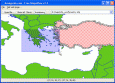
GeoclipSolo v.2.5.0.33
Géoclip Solo includes a building tool which is described above. It also includes a base map conversion tool (see picture opposite). The geographic layers which are assembled to build a géoclip are in the swf format.
MBBuilder v.1.5.10.1256
MBBuilder is a visual Rapid Application Development (RAD) tool for MapInfo MapBasic with features, typical for this products category: - Menu Editor - Toolbar Editor - Project Manager - Component Editor - Object Inspector - Dialog Editor.
Encom Discover v.12.0
Encom Discover is the desktop Geographical Information System (GIS) designed especially for the geosciences, providing the tools to effectively compile, visualise, analyse and map spatial geoscience data.